By David Clements/Special to Langley Advance Times
Drip, drip, drip… is that the sound of the persistent leak in my bathroom faucet?
Or, is that the sound of water invading my son and daughter-in-law’s apartment amidst the drastic freeze-thaw cycle that burst a pipe upstairs a few weeks ago?
Or, is that the sound of rain drops falling torrentially over the Nov. 13 and 14 weekend throughout the B.C. coastal region?
Any way you hear it, do not underestimate its power.
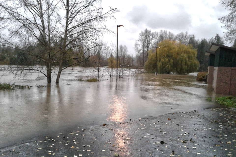
On Nov. 15, when I arrived at Trinity Western University, my normal route to the science building was blocked by over a metre of water, and nearby Glover Road was covered in water overflowing the banks of the Salmon River.
RECENT GREEN BEAT: Campbell Heights area can and should be saved
What to me was a minor inconvenience was an unmitigated disaster for many in our region.
Residents awoke that awful Monday morning to much of the Sumas Prairie underwater, with the Sumas Lake re-forming in the basin drained in the 1920s.
The toll on property and livestock was horrendous with 628,000 chickens, 12,000 hogs, and 420 dairy cows estimated to have fallen victim to the floods.
It rains a lot around here, especially in November.
So the steady dripping that weekend caught most of us off guard.
Daily and monthly rainfall records were broken all over the place, including a record 154.6 mm rain falling in Chilliwack on Nov. 14.
The previous one-day record for Chilliwack was a mere 115.8 mm on Nov. 2, 1955.
This atmospheric river coupled with the drip, drip, drip of snow melting in the nearby mountains combined to create the catastrophic flooding, not only here but in the B.C. Interior and on Vancouver Island.
Why?
The scientific answer is that climate change has a lot to do with it – not the floods themselves – but the more extreme flooding.
These events are predicted to become more and more extreme as we continue to log warmer and warmer average planetary temperatures, setting up the “perfect storm” for more and larger atmospheric rivers.
As well as looking forward, we need to remember the past.
The verdant Fraser Valley was created by masses of glacial meltwater flowing into the Salish Sea thousands of years ago.
Its rivers have continually changed course through history.
In our efforts to control nature, we have confined some of these rivers in dikes, putting these once winding rivers in “straight jackets” (e.g., much of the Nicomekl River).
Fortunately other rivers like the Salmon River still run crooked and are still free to overflow their banks occasionally, making them much better habitat for salmon and other wildlife.
These events actually add to the fertility of the farmland as an added bonus.
It just means that once and a while these rivers will naturally overflow their banks, reminding us of the power of water.
PAST GREEN BEAT: Langley first outside Vancouver to approve climate action plan
RECENT GREEN BEAT: Beetle sighting evokes childhood memories for Langley scientist
.
– David Clements PhD, is a professor of biology and environmental studies at Trinity Western University
.
story tags