Unsworth elementary students have been exploring every corner of the country over the past few weeks, with the help of Canadian Geographic and the Cable Public Affairs Channel (CPAC).
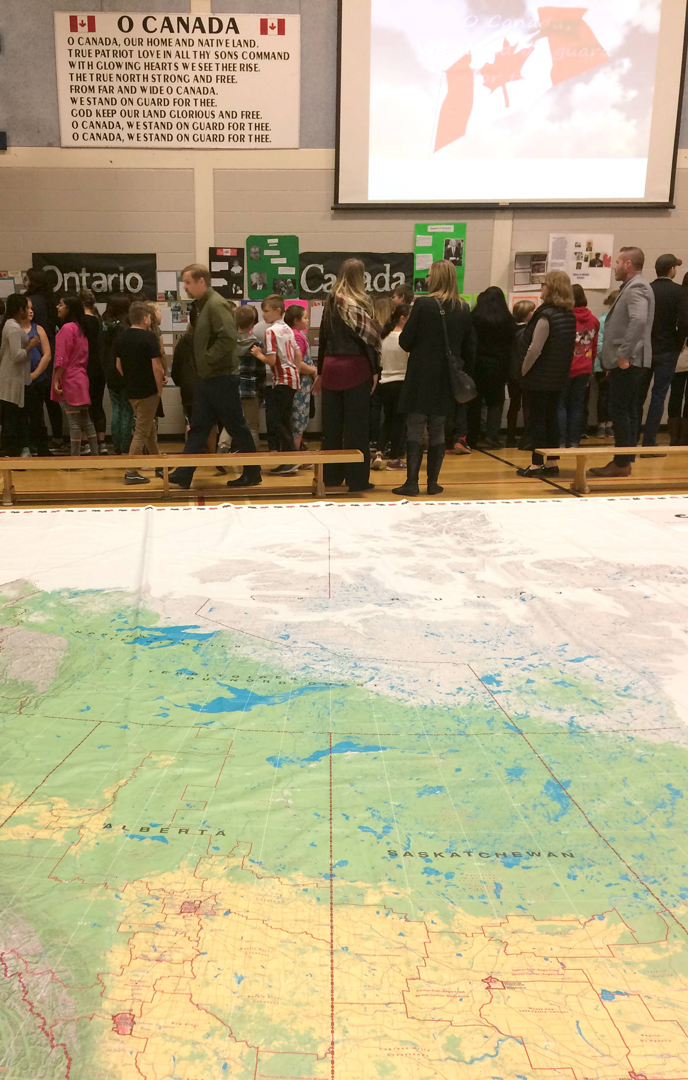
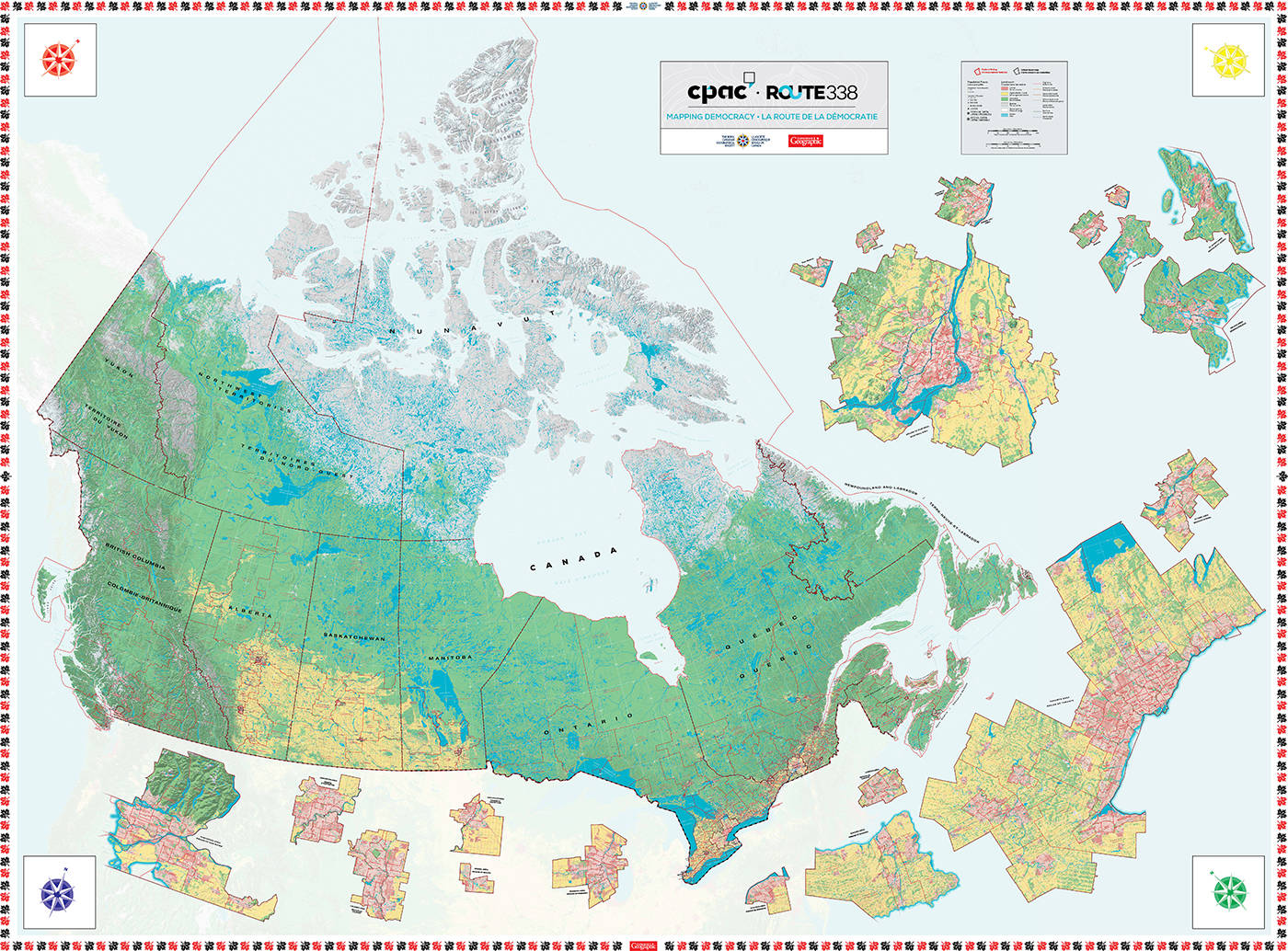
Their research culminated into a final public presentation called Democracy Day, held last Thursday in the school’s gymnasium. The school’s Grade 5s and 6s had a chance to show off what they’ve learned about the nation, its history and its people. In the centre of the gym was a giant, 24 by 36 ft. floor map — large enough to show the tiniest dots of land, and thinnest slips of river water. And surrounding the map, on the walls of gym, were well-researched projects, drawings, maps, photographs, family histories, and biographies that sum up what Canada, its provinces and territories mean to each student.
The project was led by teacher Kelly Urban, who worked with both Canadian Geographic and CPAC to bring the giant map to the school. It’s a part of the CPAC project called Route 338. Anyone can go online and research each of Canada’s 338 anytime. For Chilliwack-Hope, the stunning photos of city councillor Chris Kloot were used. There is brief information about MP Mark Strahl, and a “fast fact” that Strahls have been in Parliament for this riding for 22 years. The Chilliwack-Hope page includes information on the environment, history, culture, economy, and more.
And as part of the project, teachers across the country can access the giant floor map along with lesson plans to help bring the Route 338 website right into their classrooms.
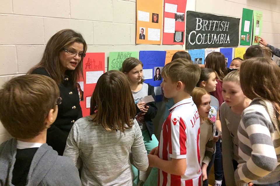
Part of Unsworth’s Democracy Day included a visit by Chilliwack Mayor Sharon Gaetz, which pleased the student who was tasked with researching her. She spoke to the students as they sat on the map, and then toured around the gym to hear what they’d learned.
Avrianna Cools, for example, dove into the subject of the Charlottetown Conference, September 1864, as part of her research into Prince Edward Island.
“Nova Scotia, New Brunswick and Prince Edward Island wanted to merge their railways into a single unit, but they didn’t have enough money to pay for it,” she explains. “They asked Canada, but Canada refused. So they fundraised.”
Her classmate Nathan Strong continues the story from his project, explaining that the railway project put the maritimes into debt. The British landlords had borrowed too much money, and Canada eventually offered to pay them to join the growing nation. That happened on July 1, 1873.
There were also students who learned that their grandparents worked the land in rural Saskatchewan, and students who learned about trailblazing female politicians in Canada’s far north. All students in the school had access to the map, from the projects on display last Thursday, right down to the kindergarten students who compared the sizes of lakes, provinces and oceans to their own bodies.
CPAC says they created the project with Canadian Geographic as “part of our efforts to contribute more actively to Canadian’s understanding of their democratic system and to educate and engage our youth as we believe that education is key to maintaining a strong and healthy democracy.”
To learn more about this riding, the Route 338 project, and how to bring the map to your classroom, download a Canada quiz app, or see lesson plans, visit route338.ca. The map is available on loan free of charge for a 3-week period throughout the school year and by special request during the summer.
@CHWKcommunity
jpeters@theprogress.com
Like us on Facebook and follow us on Twitter.